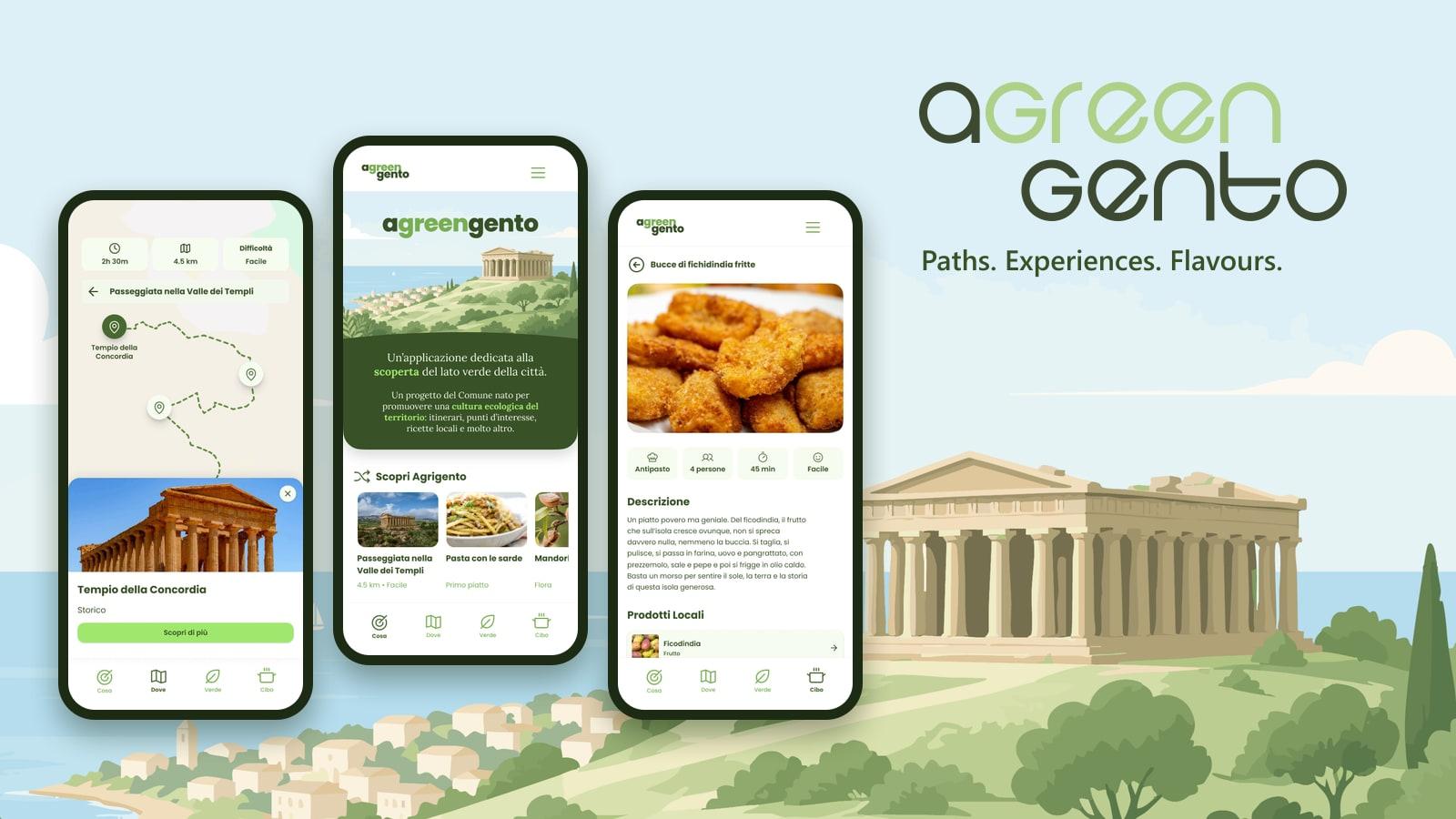
- GPS-guided itineraries: Georeferenced routes drawn from GPX tracks, with points of interest on the map, walking time and difficulty.
- Interactive map: Google Maps base map with points of interest and live weather.
- Nature and territory: Dedicated sections on the local flora, fauna and geology.
- Local flavours: Traditional recipes and typical local products.
- Green section: Live air quality (PM2.5, PM10, O3) and an eco-impact questionnaire that estimates the carbon footprint of a visit, based on how visitors travel, sleep, eat and move around.
- News and project info: Updates and background on the Naturalmente Agrigento project.
- Four languages: Italian, English, French and German.
- Set up the WordPress instance used as the app's headless CMS.
- Configured the Google Maps SDKs for Android and iOS.
- Set up the Open-Meteo account for weather data.
- Mobile app: Flutter (Android and iOS)
- Content management: Headless WordPress via the REST API, with Advanced Custom Fields for custom content types and Polylang for translations
- Maps and location: Google Maps SDK, GPS tracking, GPX itineraries
- Weather and air quality: Open-Meteo APIs
- Infrastructure: Cloudflare, CI pipelines for Android and iOS builds